Collages and Maps
Created: 2023-07-26 (12:00:00) — Modified: 2025-06-29 (18:13:16)Status: in progress
I tried, initially, to create maps in pen and ink. But the maps didn’t look like maps. They resembled aerial views, landscapes you might glimpse leaning out the basket of a hot air balloon. Even creating them it was difficult to keep things schematic and not get carried away rendering the depth and light and shade, as though they really were imaginary little spaces, and not imaginary representations of imaginary little spaces.
I’m interested in why, switching to collages, they much more readily looked like maps than the pen and ink. One reason might be that there is more of an affinity between collages and maps, than there is between drawing and maps. At least for some kinds of maps, topographic maps, feature maps, tourists’ walking and cycling maps, which superimpose signs and symbols over a two dimensional field of colours, tones and patterns. These maps are something to be read like a book, rather than viewed and inhabited like a drawing. I’m not sure if in normal conversation we’d discuss the meaning of a map, unless we were being perverse, trying to read it against the grain, to pull out its covert political assumptions and messages, as opposed to simply trying to interpret it because we were lost.
Collage can operate in the same way through its mingling of images and text. There is one way in which it can be straightforwardly seen to construct its own internally coherent space, depending on how agreeably its pieces have been arranged. But there is another way in which, disaggregated into all its component pieces, a dialogue that emerges from their being placed in such close contact with one another. We read into their geneaology, what they might have once been used for and still represent. We roam over them like symbols and fields of colour on a map.
Jerry’s Map
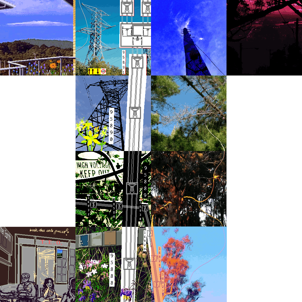
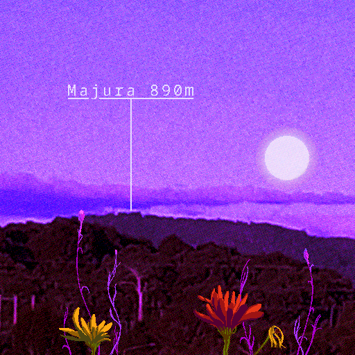
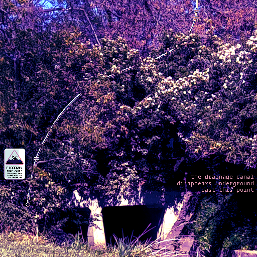
I own two that are about A4 in size, collages on a goodweight cartridge paper, bright and colourful, but certainly not precious about their own materiality. I appreciate that, being someone who often gets too precious about the things she uses to make her art. Old maps cut up and rearranged are the dominant element, but so are bright areas of coloured card and direct interventions with pen and marker. An absence is pasted over the top, ostensibly destroying the map underneath, called Void, but it is constructed out of lightweight printer paper through which ghostly outlines of the lost terrain are still visible. I can see traces of the glue. Void, structurally speaking, is an additive not subtractive force. Nothing is ever erased in a collage unless it’s physically chopped out.
Jerry’s maps are undergoing continuous revision in a manner that I don’t wholly understand. On the back is something that looks like an accessioning table, which lists out the date on which the map was created, or finalised, its coordinates, where it fits in with all the other maps and its generation, which assign it to a numbered era in the history of this imaginary terrain.
Programme
Perhaps each map tile can be determined by a set of constraints. Each map must connect in some manner to the adjacent ones, even if sometimes the connection is more sympathetic than literal; for example, a doorway in one map and an enclosed balcony in the other, or through an implied relationship of containment. Each map must incorporate a phot from the territory it purports to map, even if that photo is substantially altered or too blurry and obscure to serve as a landmark.
More on those sympathetic relationships of adjacency and containment. I like that this threatens the two dimensional order of the project. Each map is ostensibly connected to the others at its left, top, right and bottom edges. A larger map segmented into chunks. But now there may be maps sitting above or below this plane, or encapsulated within other maps, or in some way coincident with eachother, separated by time or possibility rather than space. You may, for instance, have to refer to insets, or click away to explore some strange sidechannel bottlegrotto. And navigating the world being represented becomes more complicated and contingent.
So having written all this out, here is a little program or programme for this world:
- Each tile is the same size, 512 by 512 pixels.
- Each tile must be connected to at least one other tile, through adjacency, through containing, through being contained, but these connections may also be sympathetic rather than strictly literal.
- Each tile must contain:
- something that incorporates a fragment of the place it purports to represent, a photograph, an artefact, a text extract…
- something added in by hand, a field of colour, flowers, signs, structures, symbols, trails…
Endmatter
Tags: @collages @in-progress @maps @virtual-spaces
Return to: Ormulum